
In the course of brainstorming a vacation home for my character Decca Roadhouse, I’ve thought of another character, Georgia Roadhouse, her little cousin who’s just like her, right down to having a vacation home, sporting red ringlets, and guzzling red wine, but, in stark contrast to Decca, is a wallflower who basically never strays from her solitary bookish pursuits.
Since Decca is definitely not going to have any kids, and Decca and Georgia are the only young members of the whole family (who all primarily reside in a big house in Abingdon, Virginia), I thought it would be kinda sad to leave Georgia without any kids either. Or a husband, for that matter. But no matter what variant of a meet-cute, a romance, or a relationship I thought of it didn’t quite seem to suit her. She needs something a bit different that plays to her sage wallflower nature.
And then, today, it hit me: if she experienced a blizzard in the romantic atmosphere of Christmas at her vacation home in the Shenandoah, and happened to meet her special someone during such a storm, that might be just what she needs! It would be something different and unique, and the storm is an exigency that would stop her from just disappearing back into the woodwork like she usually does.
Now, I’ve already done a big Christmas snowstorm in a story (though I’m only going to release it as we get closer to the holiday season), but there was no romance in that one. And in “Heart of Proxima” there is a White Christmas, but only long after the romance starts.
Besides, I’ve got a unique angle in mind for this one that doesn’t appear in either of those stories.
Worldbuilding the Storm of a Lifetime
I’m thinking that this blizzard will be exceptionally severe: record-setting stuff. Indeed, even record-smashing. What could cause a record-smashing snowstorm to hit the Shenandoah over Christmas? One could simply posit a very strong and/or long-lasting nor’easter, in a more intense version of the usual setup, but that’s just too vanilla.
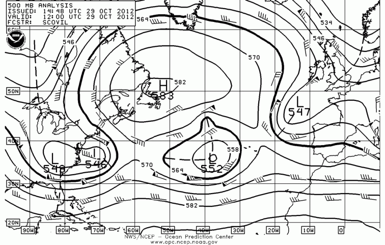
Instead, why not a setup inspired by 2012’s Hurricane Sandy? Yes, hurricanes do produce snowfall, if they interact with a sufficiently cold airmass, and Sandy was the standout performer in the temperate world in recent history, though it may have been exceeded by an 1804 hurricane that hit New England.

Storm total snowfall for the period when Hurricane Sandy struck. It’s even in the Appalachians, the same area Georgia’s house is located!
Hurricane Sandy makes an interesting prototype in yet another respect: its unusual, even exceptional track. Hurricanes, particularly late in the season, typically “recurve” toward the northeast and then the east as they migrate northward out of the tropics, due to prevailing wind flows at temperate latitudes, but as you can see in the track below Hurricane Sandy started to recurve northeastward but then suddenly turned westward.

How could this be? Because of an unusual weather pattern in the Atlantic: a strong upper-level high was over Newfoundland, blocking northeastward progress in that direction. Indeed, its clockwise circulation steered the storm westward. Not helping the push to the east was another low-pressure system that was near the Azores, its counterclockwise circulation likewise steering the hurricane-cum-nor’easter westward.
The final piece of the puzzle was a trough over the eastern United States, keeping temperatures there chilly in advance of the storm, and, being located southward of the hurricane, steering it northwestward with its own counter-clockwise circulation. All these factors conspired to steer the hurricane toward the northwest, and ensuring its capture by a strong upper-level trough (hurricanes don’t normally have a strong upper-level signature, so seeing Sandy off the coast of North Carolina here is a sign it was already transitioning out of the tropical range).
Often the very strongest cold-core storms have an extra oomph provided courtesy of a tropical cyclone; the 1991 “Perfect Storm” for one. An even better, but more obscure, example would be the great storm of November 2014 in the Bering Sea, which formed out of Typhoon Nuri and set a new record low pressure for any storm in the region (920 millibars; for comparison, Sandy was 940 millibars, and the “Perfect Storm” was only 980 millibars). The typhoon altered the jet stream as it passed through Alaska, sending a massive wave of cold air into the United States later that month; monthly record lows fell from Casper to Joplin, and an epochal lake-effect snowstorm was triggered, dumping up to 7 feet (!) of snow in parts of western New York.
Notice, though, that all this is happening in October and November, months that are known for hurricane and typhoon activity. The last half of December might be more of a stretch. Not too much of a stretch, though. Off-season tropical storms and even hurricanes have been known to happen. In the annals of Atlantic tropical cyclones no less than 8 hurricanes have been recorded in December and January; a Category 2 hurricane even occurred once in March, the month sea surface temperatures are at their coldest.
Hurricane Sandy when it was fully tropical peaked as a Category 3 hurricane with a pressure of 954 millibars, much more intense than any off-season hurricane in recorded history. Nevertheless, we might posit exceptionally favorable conditions in the Caribbean for so late in the year, enabling the blossoming of a freakish tropical storm, which then moves northward.
Let’s posit a setup similar to late October 2012 in the Atlantic basin: blocking high over Newfoundland, with the eastern United States under a trough. I’m thinking that the region will be under a cold wave similar in intensity to November 2014, due to a similar setup involving a late-season typhoon going extratropical beforehand and “kicking” the polar vortex at Alaska, cascading down deep into North America. Thus the eastern United States will be bathed in arctic air even before the hurricane strikes, ensuring exceptionally cold temperatures; given that this is late December instead of November, the temperatures will be correspondingly colder than in November 2014. Think something like the Christmas 1983 cold wave.
Indeed, if there was an arctic outbreak in the eastern US combined with exceptionally favorable tropical conditions in the Caribbean, this suggests sea surface temperatures might be very warm in that region; this means the temperature gradient between the tropics and the temperate zone is much more pronounced than normal, which is an ingredient for explosive formation of exceptionally strong storms along the East Coast. Throw in the hurricane component…hoo boy, it’s going to be one wild sleigh ride.
As the Christmas hurricane goes down a similar left-hook track that Sandy did, it finds itself captured by the polar vortex, and they gradually merge and intensify into an exceptionally powerful nor’easter before making landfall. Given that the polar vortex is very distended, it’s entirely possible the combined formation would be more or less detached from the jet stream, forming a “cut-off low”, similar to the February 25-27, 2010 blizzard (fun fact: that one was infamously referred to by Accuweather as a “snowicane”; they need not have jumped the gun on that term, considering a real snowicane would show up less than 3 years later…).
A Storm that starts to scare even Me…
Anyway, how powerful would this nor’easter get? Sandy bottomed out at 940 millibars (lower pressures are more intense), which was actually a record low for the area it made landfall in (near Atlantic City). Given that the ingredients for our fictional storm are much more intense, a much lower pressure could be expected. How low could it get? The 2012 superstorm does not hold the North Atlantic pressure record; that honor belongs to the Braer Storm of January 1993, which bottomed out at 914 millibars off the coast of Iceland.
The Braer Storm boasted wind gusts of up to 120 miles per hour, with sustained gale-force winds stretching from Newfoundland clear to Spain, a diameter of around 2000 miles. Extratropical storms have much less intense maximum winds than tropical storms do; Sandy only had Category 2 sustained winds when at 940 millibars, a pressure usually associated with a Category 4 hurricane. However, due to the winds’ spread over a much larger area they can often produce higher waves and storm surges than their tropical counterparts do. Indeed, for all the hype summer hurricanes get, an awful lot of the beach erosion and coastal home damage that occurs on the East Coast is actually the handiwork of winter nor’easters. Sandy set new benchmarks for high storm surge in large swaths of the Northeast.
Anyway, given the somewhat regular occurrence of extratropical storms reaching down to about 920 millibars and into the 910s I can’t help but wonder if a “perfect storm” might reach below 900 millibars, a benchmark hitherto only known from topical cyclones and tornadoes. If any storm would reach it off the American East Coast it’s this one we’re positing here.
Be it 899 or 940 millibars or anything in between, there will no doubt be a large swath of blizzard conditions associated with this storm. The Shenandoah will no doubt be one of the harder-hit areas; Georgia’s vacation house is on one of the ridges (Big Meadows Visitor Center is an example of such a site that has a weather station), which is actually high enough to be out of the humid subtropical climate zone and into the humid continental zone, i.e. it has a persistent snowpack in an average winter. Big Meadows, in fact, has recorded Virginia’s all-time highest snowfall for one 24-hour period, 33 inches in 1962, and highest storm total snowfall, 42 inches in 1996.
Given that our hypothetical storm would be a top-tier snowstorm with almost optimal conditions for pummeling snowfall into the Shenandoah’s ridges, we can expect that 33 inches per 24 hour pace in 1962 to be at least matched, if not substantially exceeded (given the exceptionally cold air mass in place, leading to more powdery snow, i.e. more snow for a given amount of moisture). And because it’s a cut-off low the same conditions will be in place for multiple days.
So…if the 1962 pace is even matched and the storm just lasts for 3 days at a stretch, that would equal a storm total of 99 inches (8 feet). Yikes. For all we know such a setup might even double the 1962 record pace, leading to a storm total of around 16 feet, deep enough to entirely bury the first floor of a house and most of a second floor! And that’s before drifting is taken into account: given that wind gusts could easily exceed 100 miles per hour for days on end, snow drifts would very easily overtop two-story houses, leading to whole sides being completely encased. Three- or even four-story houses might be entirely covered on their windward sides.
Needless to say the local and regional infrastructure would be shot to pieces; these are the sort of numbers you expect to see in the Sierra Nevada, not the Appalachians. It would be a storm for the ages.
The storm would pull even colder air down southward on its western side (i.e. the side getting north winds) as another reinforcing shot from the arctic comes in, much like Hurricane Sandy did (it got cold enough for central Ohio to get lake-effect snow…in October; a December version would be correspondingly more intense). Given that there was already a cold wave to begin with, it’s possible that all-time record lows might fall during the storm; for reference, Big Meadows’s all-time record low is -26 degrees Fahrenheit. Hurricane-force winds at that temperature would bring wind chills to below -70 degrees Fahrenheit, exceptionally cold for the Shenandoah.
Saint Elmo’s Fire…in a Blizzard? It’s happened before…
Also exceptional for the Shenandoah would be the copious thunder and lightning associated with the snow squalls, persisting through Christmas Eve and Christmas Day…and after Christmas. And perhaps Georgia might see even more exotic phenomena: on January 17, 1817, New England was subjected to a blizzard that involved thunder, lightning, and Saint Elmo’s Fire that lit up trees, fence posts, house roofs, and even people. Saint Elmo’s Fire, for reference, is a phenomenon involving a blue or violet sparky “flame” of plasma that hisses and buzzes from the ends of a rod-shaped object, caused by strong atmospheric electrical fields. Experiencing that during a snowstorm is something Jim Cantore can only dream of…
In Georgia’s case, she might not even need Christmas lights for her Yuletide to be bright! Woo.
Snowbound Romance
And this is where she’ll have a life-changing experience. Remember what I said earlier about how Georgia was going to meet her special someone? Well, if in a storm like this, she finds a man at her house’s door in desperate need of shelter, how could she turn him away? He’ll be suffering from hypothermia so bad he’ll not really be lucid anymore, viewing Georgia as something like a dream girl or an angel (not helping matters will be the Saint Elmo’s Fire on her at times…she really will look angelic!). She’ll bring him to the guest room and nurse him back to health, keeping him there until the storm lets up, where they’ll spend Christmas together by force of circumstance, and finding they not only get along well, but also have the hots for each other.
I’m thinking her mysterious visitor will be young, perhaps even younger than she is, have snow-white hair, perhaps dyed platinum white, and be as much a bookish wallflower as she is. I’m toying with ideas about him having a hole-in-the-wall library type of dwelling not too far from Georgia’s, only they had never met before. He wishes to enjoy the historic storm before it gets too bad, so he heads out, but he goes way too far for his own good as the storm is a much more fearsome opponent than he anticipates, putting his life at serious risk until he finds Georgia’s residence by sheer chance.
It’s one of those serendipitous meet-cutes that’s ordained by fate, which is exactly how a character like Georgia would find her soul mate, and I’m sure she wouldn’t have it any other way. Indeed, she’s so introverted that a scenario like this is about the only way she could find love.
Once the dam breaks, how quickly will they defrost? To passionate kisses? To being as physically intimate as a man and woman can be with each other? To wanting something more: marriage and children? Won’t Decca be surprised when she skis in after the storm and finds her little cousin is now someone else’s little beloved, wedding bells in their ears and giddily looking forward to having children together.
Ah…another magical Christmas. I’m already liking this idea…
3 Replies to “A Christmas Blizzard Romance in the Shenandoah?”